Morganza Spillway Opens Saturday
After talking to several concerned readers, I decided it was way past time for me to address what is going on here with the Mississippi River flooding. And of course, I expect my very well-read readers to correct me when I am wrong; but there is a LOT of information out there to be found on this topic. By now, all of you know that Memphis has flooded, and Vicksburg is flooding, as the river crest continues to flow southward.
Granted it does feel sort of strange reporting to you like this, but I want to help you understand what we are facing. Again, information is being updated constantly, and by the time you read this, there will most likely be newer numbers to report.
The opening of the Bonnet Carre Spillway just south of Lake Pontchartrain will be completed in a couple more days to relieve the pressure off the Mississippi as she rises to flood stages along her levees. The bulk of this freshwater is running into Lake Pontchartrain, north of New Orleans, and this effort lowered the Mississippi at New Orleans by one foot last night.
This spillway is about 65 miles northeast of Bayou Dularge.
Early this evening, Governor Bobby Jindal announced the Mississippi River Commission is going to open the Morganza Spillway, located 145 miles north and slightly west of Bayou DuLarge, sometime in the next 20 hours. The town of Morganza where the spillway is located is being ordered to evacuate tonight and tomorrow morning, as the La. State Troopers are closing the roads in that town at 10 a.m. Saturday.
Here is a PDF Flood Inundation map from the Army Corps of Engineers (ACOE) that I want you to open and then put at about 50%. You won’t be able to see the whole map at once, but let’s look at the upper left quadrant first. After you open it, and get to the quadrant, I would like you to find a little town named Simmesport.
Very near Simmesport is something called the Old River Structure. At this point, about 30% of the river is redirected by this structure to flow down into the Atchafalaya River. The short version is that the Mississippi River has changed course about 7 times over a period of roughly 7000 years. That is about once every 1000 years. If this control structure were to fail, the Mississippi River would alter her course and overtake the Atchafalaya, causing serious flooding as she went.
But right now, we can’t even consider that scenario, for all eyes are on the Morganza Spillway, which you will see on the map if you scroll down a little, and look southeast of Simmesport. Morganza is right there where the yellow and green colors start. If you now scroll straight across the right, you will see the legend for what colors indicate what water heights. Now, scroll back to the left and scroll down to where you can see more of the colored areas.
You will notice that to the right, there are thinner lines of color which follow the current route of the Mississippi River. Those areas of flooding are minimal and tight to the banks. However, if you look at the Atchafalaya Basin area on the left, that is where the major flooding and inundation will take place after the Morganza Spillway is opened to just 50% capacity, allowing the river to flow through at a rate of 150 thousand feet per second.
The idea is that the Bonnet Carre spillway has taken some of the pressure off the lower Mississippi now–before the crest arrives at Baton Rouge and New Orleans. The idea behind opening the second spillway, farther north, is to divert as much of the river as the spillway structure can handle, flooding rural, bayou, marsh, and swampy areas in order to spare Baton Rouge, New Orleans, and all parts in between. That is understandable since Baton Rouge is a hub of petrochemical industry, and New Orleans is a huge shipping port.
Right now, water levels at a lock at Port Allen, on the western bank of the river just opposite Baton Rouge, are as high as they can be and still allow vessels to safely navigate the locks. If the water rises one more foot tonight, the locks will be closed to navigation, costing the economy about $1 million dollars a day. All this at a time when our economy can’t take that stab.
Someone on Face Book said it best, “Can’t Louisiana get a break?” Obviously, we cannot. Let’s go back to the map, though. Go ahead and take your time and look at and get familiar with it.
Let’s go down to the bottom two thirds in the middle of the map. Locate the large purple area, and then look for the box holding the name of my parish, TERREBONNE. Now, look just below the last “E”. That is where I live. We are in the area that stands to only get 0 – 5 feet of flooding if the Morganza is opened to 50% capacity.
The Miracle Bayou Tree House is about 12 feet above sea level, so no worry there. The slab under the house is about four feet above sea level, so we should be pretty good there, too. If we park the vehicles, riding mower, and boats on the slab, they should be fine.
Now, let’s understand why the water levels decrease as they come along. This map is a little outdated already, because last report said that Morgan City (can you find it?) is going to possibly have 20 feet of water after the Morganza is opened 50%. That water will slowly make its way into the bayous and canals and then will seep through the swamps, marshes, and backwaters making its way down here to us.
That is why we will only get 0 – 5 feet of water. This is the complete opposite of the storm surges we are used to. They come rushing in from the Gulf and just slam us. This water is going to come creeping like a silent octopus with thousands of arms reaching out to grab us. The truth is, not even the expert ACOE know what is really going to happen. They are just making educated guesses because the media vultures demand they have something to report.
Take a look at the map below. This is a newer map and the colors have changed. Our bayou community is below the city of Houma, in the color blue.


Please realize that this structure has only been used once, back in 1973, at about 30% capacity, when the river reached a volume of 1.5 million cubic feet per second. Recent reports have stated that witnesses to that opening in 1973 say the volume of water made the structure shake, tremble, and vibrate so badly the onlookers thought it would collapse. The river is flowing tonight at 1.45 million CFS, and rising. It’s time to pull the trigger, and we can only hope the antiquated spillway holds up to the pressure.
Everything I said above is the “best case scenario”. The worst case scenario, which I hesitate to even mention, is that the Old River Control Structure would give out, and there would be no end to the flooding. Or the Morganza Spillway could not handle the flow, and would fall apart, and non-stop flooding would ensue.
Below is a map of the “worst case scenario” for New Orleans–not the worst case scenario for the rural areas southwest of the Crescent City. Here is a link to the map so that you can see it in its entirety and up close.

At this point, I am not worried about our community. However, I am very concerned for all my friends that live in the areas that are going to indeed flood. I am praying that their suffering will be minimal. I have a friend whose family has a farm in the northeast part of the state where flooding has begun. They have corn and cotton in the fields they cannot harvest and 1000 head of cattle that they will not be able to evacuate. These are the folks who need our prayers.
As the water gets closer, I hope to be able to keep you up to date.
Please feel free to ask questions, and I will answer them to the best of my ability, and if I can’t, one of the other readers will be able to do so. Thank you all so very much for your care and concern about our bayou communities. God knows we have had our share of catastrophe and it would be nice to “catch a break” for a change.
It is now just a game of wait and see.
BW

BW, my prayers are with everyone involved in this. I hope all goes as planned and the losses won’t be tremendous. It breaks my heart that your beautiful state just keeps taking hit after hit. This has been one strange year for bad weather events all over our country.
A very genuine bayou thanks headed your way, Mamabug!
Thank you Captn’ – As always, an EXCELLENT explanation.
We live in New Orleans, and we were flooded with 9 feet of water when our local floodwalls failed. We know all too well the anxiety, tears, finanicial impact, and plain ole heartbreak. “God Bless Us One and All”
I posted this up before I was quite finished, so now I think it’s finished. Yes, I hate to say that many of us in the coastal zone now know what it’s like to experience flooding. I’ll take that blessing! Thanks! I pray the city is safe, too.
BW- I have so many friends in Morgan City and Butte la Rose and the Catahoula area-some have acres of crops in; sugar, corn, new rice-others have crawfish fields in full harvest mode. Others of my friends have homes (not camps) and businesses and family in those areas. I can understand your concern for you farming friends I am so worried about my friends too. I am praying for all. God willing the Morganza holds up -at least some will be spared further south. I don’t even like to think of the “worst case scenario”! I have looked at that map so many times in the last few days it’s made me cross-eyed. Yours was one of the first few areas I checked out and I’m sure not everyone in Dularge is 12 feet up. So sad. I know you are also praying for friends and neighbors. May God keep you all safe.
Those are the folks I am praying for the hardest, Moura. Oh, how I hope they are spared.
Thank you for such a good description of what is going to happen. I’m now in points north and have only heard bits and pieces. Your report is the best I’ve heard. It’s amazing how quickly the water is rising. I was at the Morganza spillway about a week ago with no water in sight. I hear St. Francisville down by the river has water up to the roofs of houses already. Louisiana is in my prayers again!
Better late than never, huh Kim? You are very welcome. I know you said they ran you off the levee. And now, no one is allowed on any levee anywhere. Too dangerous. I went up on a levee Wednesday night, and the river was raging there in St. Charles Parish and was already amazingly high. Safe travels, Kim!
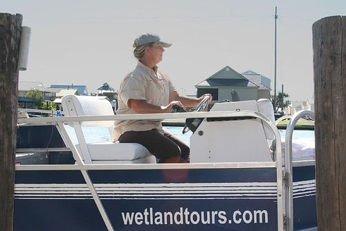
Thank you for this excellent explanation. I was lucky enough to take a wetlands tour with your last semester with Dr. Walton. I have recounted the trip time and time again. I have had every intention of booking a tour for my family…when we’re past all of this, I will definitely do this. I will be sharing this post with friends and family. This is the best explanation I’ve read so far. Thanks for all you do for Louisiana!
It’s so good to hear from you Anne. Are you still at Nicholls? Everything on the tour route is so beautiful and green right now. I’m so glad that you took away something from the tour! And thanks for sharing this post! BW
im uploading todays videos now. i filmed the ORCSLS (Old River Control Structure Lower Sill) on tuesday, and again today. the river rose 2+ feet between those times
http://www.youtube.com/watch?v=y9Dw89F1nFY
Lee, if you would, please share a little with us about who you are and your interest in filming the ORCS. And thank you very much for sharing your video with us. Now, we have questions, so if you would please be so kind as to come back here and converse with us? My question is are you familiar with the flow through the structure on a “regular” day as opposed to what we see in this video? That river is RAGING!
I am Lee Alessi. A former Baton Rouge Cop, now a Private Investigator. I was born in june of 73, so i missed it last time. We have a website that encourages preparation, and planning for such events, and we help each other. I do NOT have the figures nor video for “regular” flow. but the first attached video is from tuesday. this one is from yesterday. look at the difference. all of my videos are shot in HD, so if you go to youtube you can watch them in 1080p to REALLY see the detail. They are watching the erosion of the bank in the video, iirc
http://www.youtube.com/watch?v=Y_HNsHc-P4Y
May Gods grace be with all of you in all the states/counties/parishes that this is affecting.
It makes me so sick at my stomach and really hurts to see so many suffering and worrying again about their homes, jobs and loved ones. I will be trying to keep up with the news on this.
Thank you, Cammy, for caring so much. Chin up. No tears. Remember? Tenacity over tears, right?
I know BW but, Lord knows it is hard.
Stay dry. I grew up near a town that flooded 2-3 times a year it was always ugly but not nearly as vast an area. Someday we are going to have to let the rivers flow.
I have to ask this. In the video above, what is the red item in the water that keeps bobing up against the pillars in the middle of the structure? It looks like a canoe or kayak. I tried to pause the video but, couldn’t find a button and then the object disappeared.
I don’t know what it is but I have asked Lee to come back and answer our questions.
that is a river buoy. there are dozens of them littering the banks as of yesterday. the two stills show the difference in flow from 5-10-11 to 5-13-11. the current holds buoys, trees and debris under for a long time
http://gallery.me.com/ltalessi/100863/IMG_2629/web.jpg
http://gallery.me.com/ltalessi/100863/IMG_2803/web.jpg
thanks for your post re flooding. I found it by searching for “Morganza Spillway” at Yahoo. I also posted a MyMap at Google with a line along the spillway. I cound not find the spillway listed on either Google or Yahoo, so I found the structure at Yahoo Maps. It’s farther from the river than I expected. I live in California, and I’m a retired mapmaker who always want to know WHERE. Your post with the two maps is very helpful. Thanks again.
You are most welcome, Richard, and I happen to be a “map geek”!!! Please come back any time!
Worst Case I am in a green area. I read this morning were the waters had already breached the the levee in North Louisiana.
What I keep thinking, we still have a week before it is supposed to crest.
I am safe, my home actually pre-dates the first levee in the 1880’s and was built on piers to handle the spring floods. Bad thing is the piers are so old the mortar used back then was just cooked limestone and is worn out. Its like the storm shutters, if there is not a hurricane coming, its not a priority project….LOL
Unless its worse case, the flood way carries away the Morganza Floodway or there is a local levee breech, I will just sit on the front porch and watch the tugs across the levee. Only normally get to see the big ships passing.
BTW don’t you love the Gov? “Its like a hurricane alert, don’t wait to see if its going to happen, leave NOW!”
I’m thinking that you might not see much river traffic. My understanding is that they will be closing river traffic. So, I hope you don’t sit on your porch and watch “water” go by, but it is good knowing your house predates the 1927 flood and resulting levees. I am behind on my news this morning, so I better get cracking.
I am originally from Morgan City. It is my HOME. My Dad still lives there, as do most of my family and friends. The mayor has faith in the sea wall and the levees. I’m hoping he’s right. I’m so afraid for my HOME and that something may go wrong.
Melanie, your folks will be in our prayers. I hope the mayor is right, too. It’s good to hear from you again, just wish it were a happier topic.
Morning, BW,
I can be so slow sometimes. It wasn’t until yesterday that I thought: Henderson. Whiskey River! It’s a small thing in the larger scheme of things, but it’s the little experiences we “outsiders” have in your part of the country that tie us to it and make us as concerned as though it is our own backyard.
I have two links that may be of use to your readers. One is Dr. Jeff Masters’ current post at Weather Underground. It’s a terrifically clear explanation of how the entire system is linked together and especially of the ORCS (Old River Control Structure).
It also contains Lee’s video, and yes, that IS a kayak! For your interest, he also mentions that the flow through that thing is 2-3 times that of Niagara Falls now.
And, here is a new map showing the timeline after the opening of the Morganza. It shows the approximate time water will arrive in each parish.
Also, because wildlife is going to be having some problems, for assistance with black bears that may be forced into populated areas by flood waters, call 1-800-442-2511 toll free.
And finally, because we have to keep laughing – there’s been a suggestion for a new French Quarter act in NOLA. The Spillway Sisters: Bonnie, Carrie and Morganza!
Keep your chin up!
As usual, you are a wealth of helpful and interesting information. Thanks for taking the time to share your findings with us. For those of you reading this, Linda is an avid reader/poster on Weather Underground. There is a whole network of folks there that I have not yet tapped into that you might want to check out. Maybe I will finally get to see my first black bear? And I’ll get busy writing the screenplay for The Spillway Sisters!
Here is a link to our local paper, The Courier and today’s article about how this high water and closures will affect the economy. Please keep in mind that my sons work on these tugboats that help keep American operating.
im trying to update my website, here, facebook and gulfcoastwx….. so ill try to answer what i can. i may head back out to help a friend in need….
if you have any questions and i dont get to them soon enough, shoot me an email again… thanks.
http://www.youtube.com/watch?v=cfqto16cMOw
Thanks, Lee. We know you’re busy. Go help your friend. We got our first questions answered. The red thing is a kayak, and the speed of that water going through there is currently twice that of the Niagara. Take care and thanks for this new video.
LOL, its a buoy. not a kayak. Jeff was tongue in cheek. Its still there BTW….
I just figured that out. I think Jeff is a dear, but he really ought not be posting that sort of thing under these circumstances, because folks do look to him for accurate information!
You live on Bayou DuLarge? You must know my dear friend Charlie Matherne?
Either way, you’re on my blogroll.
I surely do! He lives only three houses down from Camp Dularge!!! Retired forestry, right?
Is he still playing forestry? I thought he’d retired by now. Tell him I said hi!
Duuh, I missed the retired part. Too early on a Sunday and not enough coffee. Stay safe.
I see him almost every day as he drives by the camp. I’ll give him a personal message but I need a name–not just pawpaw. He’s down here all the time now. No more city life for him!
I’m sure glad Lee came by to correct that kayaking business. Poor Jeff – that kayak’s all over the internet! I can’t believe I got suckered in. LOL
I did bring this by for you. Anyone can watch the opening of Morganza here, at UStream.
Linda, thanks for the link but I cant’ get it to actually “play”. It just sort of sits there and them jumps to another frame but doesn’t play any sound either. I’ve checked all my settings and played other video, so I’m not sure what the problem is with their video. Does it stream smoothly for you?
Okay, here is an up to date report from MSNBC with more maps and visuals you might want to avail yourself of. Keep those prayers coming. And thanks!
BW
I am fortunate that I can watch and learn about the river–I live in Slidell, at (I think) 7 – 10 above sea level. I’ve lived here since 1976, (I also lived here ’63 – ’68.)
I’ve found the wwltv.com link (in my blog) getting used a bunch from readers to whom “Mississippi” is something hard to spell.
And I am “keeping the beads hot” (so to speak) about all of this working.
I’m praying for all of you. I hope they get those cattle out. A loss like that… all of it… it just leaves me speechless. I wish I was closer to help.
Thank you Horseshoe Wife!!! Good to hear from you again! I don’t think they had time to get them out. I will know within a day or so how they fared.
Hi, My mother and sister both live on Bayou DuLarge on Highridge Drive. I’m having a hard time finding information regarding the flood levels in that area and wondering if I should urge them to evacuate. Do you have or know where I could find more detailed information? Should I drive the two hours to drag them kicking and screaming from their homes or will they be safe there? I’d appreciate if you could email me any info or opinions you have on this matter. Thank you. jlapey@yahoo.com
I emailed you!
Do you know the elevation above sea level of the Morganza Spillway and if so where that information might be documented? Thanks for your help.
Deanna
Welcome to the bayou, Deanna, and I hope you come back often. When things aren’t so hectic, we talk about bayou life and even have a contest once in a while. Lots of nice folks visit here, oh, and we cook, too!
I once knew a lady named Deanna Parker up in Bossier City. Surely, this is not the same one?
Yes, I can help you with that, and I am about to do a post with some helpful links. I will give it to you here, though. Morganza is about 36 feet above sea level. LSU Ag Center has a wonderful website where you can type in the address, and a box on the left will show you the GPS coordinates, the elevation, and the wind speed to which you would have to build a structure to withstand. Here is the site.
This is really great information, thank you so much for your kind welcome and the link. I am not from Bossier City, I am from Kansas. I live in Kansas City, MO now. I would love to visit sometime though. Sounds like a great place. Again, thank you so much for the great information. Have a great day.
Deanna
There are no more wild oysters in the Mississippi Sound because of opening the Bonnet Carre…..would relying a little on the Morganza help maintain the salinity levels in the Mississippi Sound and restore the water quality needed for oysters?
Pete, sorry, I do not know the answer to that question.